Fully rested, both physically and mentally, travellers continue North in search of their Jacobean dream. Fuenterroble is followed by a prominently straight stretch of the Way that is slightly raised from the surrounding land. Then it is time to circumvent small valleys, especially the one of the nearby Alagón River, the major tributary of the Tajo River, which shares its birthplace, Frades de la Sierra, with illustrious poet, José María Gabriel y Galán.
Although you would never think it, another stronghold, in the same style as that of La Calzada de Béjar, was used to monitor and ensure the safety of the route in ancient times. According to research, the defensive building was located in the municipality of Casafranca, approximately two kilometres to the west of the original Way.
From this point on, and practically along the whole of the route until reaching the city of Salamanca itself, travellers share the path with a new stretch of the Cañada Real, this time the Cañada Real de la Plata. A route for Roman troops, goods and soldiers, and for centuries it was also a route for cattle and as it is today for travellers and pilgrims heading towards Asturica Augusta, modern day Astorga. From this city located in the province of Leon and heading west, the French Way, leads straight to the final destination, the tomb of apostle Saint James in Compostela.

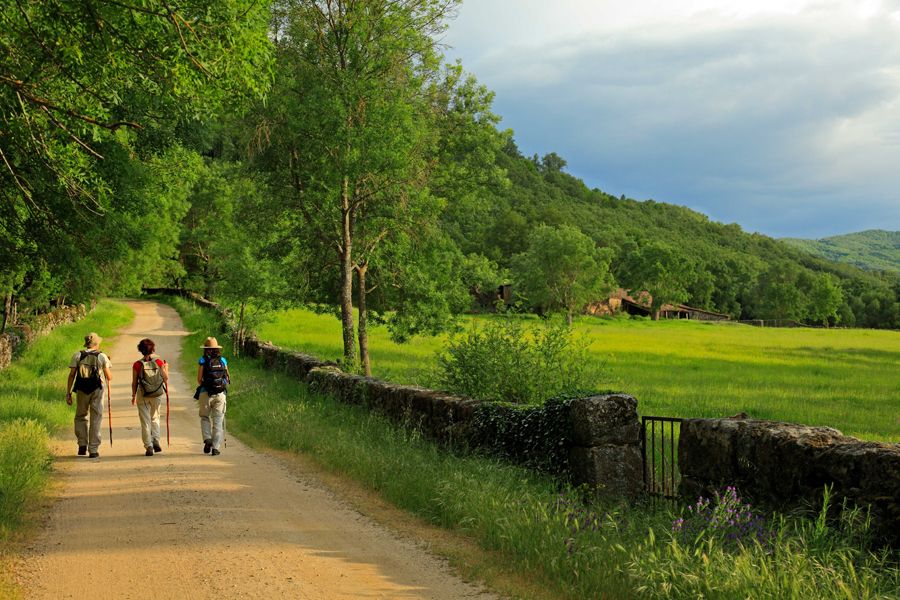
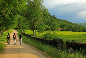
At Navarredonda de Salvatierra, the route becomes tougher and the terrain continues to slowly, but relentlessly, change. The landscape, looking more and more like lowlands, bustles with Holm oak and oak, with an abundance of shrubbery. The Way at this point is used more and more for livestock since entering the province of Salamanca and one or other gate has to be navigated to be able to make progress along this glorious hike.
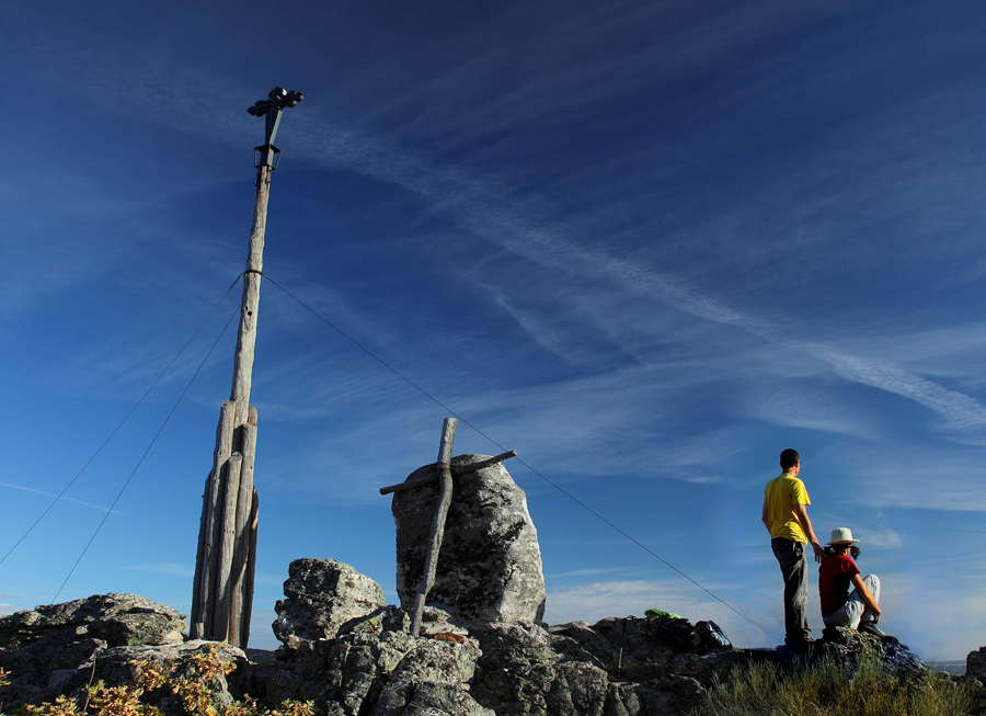
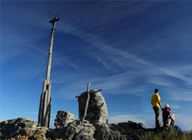
In the distance, but closer all the while, the highest point of the Mozarabic way. 1,170 metres above sea level, the summit of Sierra de la Dueña, also known as Sierra de Herreros, that the hiker has to climb before getting to the end of the second stage in San Pedro de Rozados. The ascent is not particularly tough, but travellers should be wary of adverse climatic conditions this is common in areas with sudden changes in terrain. At the summit, a Saint James Cross hints at the nature of the way, marking the end of the ascent. It is here in this undulating terrain, at La Dueña de Abajo, to be more precise, where it is said that you will find the third mansio of the charro route; that goes by the name of “Sentice”.
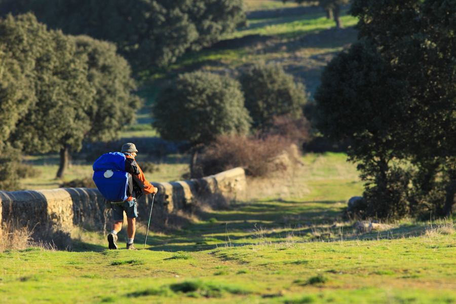
If at this point travellers are still unaware of what Salamanca is renowned for, a land for breeding bulls, it is very likely that over the next few kilometres they will see for themselves. They will already have been walking for some time among the Holm oak, the essential arboreal companion as you make your way across the dehesa charra pasturelands. But right now is when you get a first glimpse of one of these incredibly powerful specimens that graze in the cattle ranches located along the municipal boundary of Pedrosillo de los Aires, Frades and Membribe, these last two named after the Sierra, for reasons that are more than obvious. At this point, travellers find themselves atop a veritable plateau where the fields are at least 75 metres wide, the same as they were when they were originally marked out.
The place names become more and more fanciful as the path heads past the Los Mendigos stream, before reaching Calzadilla, which together go to form the name of the village. And with names like these, you don’t need to use too much imagination to envisage the downtrodden state of the people who made their way past this point. The custom continued and the official name simply reflects the day to day activities that went on there. The hamlet of Calzadilla de los Mendigos (Beggars Shoes), with houses, stables, a pigeon loft and even the ruins of a chapel, greets travellers as if the absence of human life had paid a heavy toll upon it.
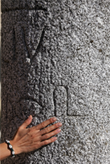
Once atop the Cabeza de Bernoy knoll, the valley below once again turns into fertile soil before reaching San Pedro de Rozados. At this point, travellers are at mile 169 of a route that starts in Roman Merida and finishes in the millennium-old Astorga. When reading up about the origins of the name Rozados (worn or chafed), which accompanies the holder of the keys to the gates of heaven, namely Saint Peter, there are at least two very interesting explanations. One, quite suitable considering its location along the route, comes from the weary feet of the pilgrims. The other, perhaps more accurate, depicts the human hands that toiled away at the soil to make it suitable for growing crops.
Whatever the true source of its name, San Pedro de Rozados usually marks the scheduled end to the second stage of the Vía de Plata as it makes its way through the province of Salamanca. Nevertheless, it is not the only option, and depending on the remaining strength of the visitor at this point, just four kilometres further up the road is Morille, one of the most interesting cultural sites in the surrounding area. Whichever spot they choose, a rest will definitely be most welcome.